![]()
The Local Time is Saturday, 27-Jul-2024 11:44:48 CEST
Towns and Villages in and around the Royal Forest of Dean |
|
||||
| YOU ARE HERE: Main Home Page > Towns and Villages |
|
||||||||
|
||||||||
|
||||||||
 |
||||||||
|
||||||||
The Royal Forest of Dean Tour and Tourist Information Guide to Towns and Villages in and around the Royal Forest of Dean |
||||||||||||||||||||||
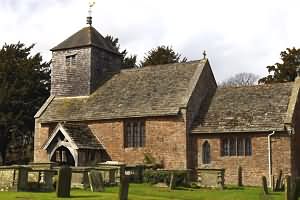
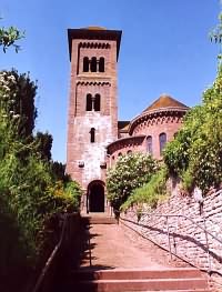
St. Michael's Church - originally built as a chapel of ease, the church was expanded in the 14th century to include nave, south aisle and tower. The arms of the Freeminers can be seen on the south side of the tower and on the 18th century font. |
||||||||||||||||||||||
| BACK TO TOP | ||||||||||||||||||||||
|
||||||||||||||||||||||
| BACK TO TOP | ||||||||||||||||||||||
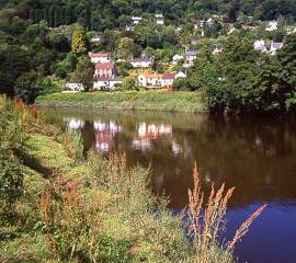
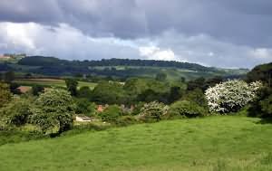
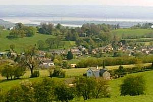
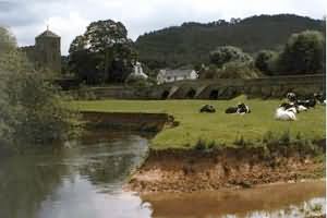
Awre retains its natural charm with traditional verges, hedges and old buildings. Its inhabitants take a pride in the looks and spirits of the village. The local Inn serves food. Pronounced 'oar' this large agricultural parish is situated south of Newnham, below the River Severn's famous great horseshoe bend and fine views of the estuary can be had from the footpath, which follows the riverbank. Awre was originally one of the largest Forest Parishes and was held by the King, but it also claimed some lands in the parish of Slimbridge across the river. In the mid-13th century, the main river channel that runs down the estuary switched its course and began to erode away the shore, riverbank and land on the Awre side. As a result of this erosion, it is estimated that Awre lost about one third of its territory and even today, the parish boundary is set about three quarters of the way across the estuary as if the parish is hoping that one day, its lands will be restored. One legacy of this period is the lost village of Woodend, which was a small hamlet lying half a mile south of Awre. This used to be some way from the river but as erosion increased, the waters gradually began to edge closer until, in the 'Great Floods' of 1741, Woodend was finally swept away. All that remains of this lost village today is a scatter of bricks and stones which can be seen at low water on the sands. St Andrews, Awre - The church of St. Andrews, Awre dates back to early 13th century and the churchyard contains a 1000 year old yew tree and under the tree, beside the church, there are graves of fishermen who drowned in the River Severn in the days of the old Severn Trow sailing ships. The church lies among scattered farms in a loop of the River Severn. It has an embattled 15th century west tower with three stages divided by string courses and diagonal buttresses. A 13th century doorway has been reset within the tower as well as a window in the porch. The church has been lightly restored by Waller & Son in 1875. Inside the church you will find a magnificent wooden chest, carved out of a single trunk of an elm tree, which was supposedly used for laying out bodies recovered from the River Severn. Outside there is a good collection of typical Forest of Dean tombstones. |
||||||||||||||||||||||
| BACK TO TOP | ||||||||||||||||||||||
|
|
||||||||||||||||||||||
| BACK TO TOP | ||||||||||||||||||||||
|
Blaisdon lies about 8 miles South West of Gloucester on the edge of the Severn flood plain. Before the Norman Invasion it was known as Blethes Dene, meaning 'wooded place'. The village turns towards the rich farmland of the Vale of Gloucester, and its land is predominantly fertile, once with many orchards growing the 'Blaisdon Plum'. Always small, the village is protected by the barriers of the River Severn and Forest of Dean The centuries were hardly noticed here, and even the Civil War of 1642 passed by it. The early houses were timber framed, built with Forest Oak, but a disastrous fire on 7th July 1699 destroyed most of the village. Subsequent rebuilding was in stone or brick, but some timber framed buildings remain. In the 18th Century the village estate was owned by Robert Hayle and John Wade, whose daughter Anna Gordon ran the estate until its sale in 1865. The Great Western Railway connected the village to the Hereford -Gloucester branch line in 1852, and steam trains could be heard in the village until 1964. A rising industrialist, |
||||||||||||||||||||||
| BACK TO TOP | ||||||||||||||||||||||
|
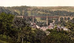
Blakeney is a small, thriving village on the eastern edge of the Forest of Dean, on the main A48 road between Gloucester and Chepstow. It was at a house called Hawfield that Thomas Stenhold was born. He was Groom of the Robes to Henry VIII and his son, but is renowned (along with John Hopkins of Awre) for publishing the first metrical version of the Psalms. The house where he was born still exists in the village. Thomas Sternhold died in 1549. Situated at the confluence of the Blackpool and Soudley Brooks, Blakeney is a busy Forest village that was a natural site for early industry (an iron forge and furnace existed here as early as 1228). The oldest building is the 16th century Swan House, formerly an inn, although there are several 17th and 18th century buildings in the village, the largest being the early 18th century Church of All Saints. Blakeney's industrial past is recalled by several buildings, including two corn-mill; the Upper Mill, by the A48 and Nibley Mill ( a partly half timbered house with adjoining stone mill where the B4431 Parkend road joins the A48). The old Blakeney Goods Station and the imposing six arched railway viaduct were built for the Forest of Dean Central Railway, which was begun in 1856 and was intended to run from Howbeach Colliery (situated about 1mile north east of the village) to a new dock at Brimspill on the Severn, it was never completed and only ran to a junction on the main South Wales line. During renovations on one of the houses near Blackpool Brook, a large high-status Roman villa was discovered. This building was located next to the Roman military coast road from Newnham and it not only had a heating system, tiled roof and a stone courtyard but also a slip-way on the stream, indicating it was accessible by boat from the Severn. Pottery on the site dated construction to c75AD, making it the earliest villa known in the Dean and it was occupied for around sixty years until being demolished sometime in the middle of the 2nd century. It is thought that it was the residence of a high ranking Roman official, possibly an Army officer from the legionary fortress at Gloucester. The Church of England church at Blakeney was built in the 1800's. Before this time, the parish was combined with the village of Awre, a little further to the east and closer to the River Severn. The font is what appears to be a 15th century stoup for holy water, believed to have been removed from Awre church during the reformation and buried for safety. It was found near Gatcombe when the railway was built, and used locally as a flower pot for many years before being brought to the church at Blakeney. In the early 1800s there was a considerable non-conformist movement from the established church, and a tabernacle was built at Blakeney in 1823, a mile north of the village. This building is now used as houses. A replacement tabernacle was built in the village in 1849 (before the church of England church was built). |
||||||||||||||||||||||
| BACK TO TOP | ||||||||||||||||||||||
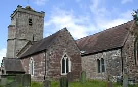
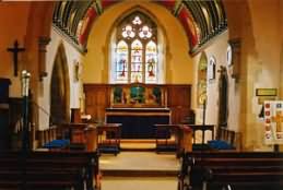
The Village of Brampton Abbotts is located about two miles north of Ross-on-Wye, Herefordshire. St. Michael's Church |
||||||||||||||||||||||
| BACK TO TOP | ||||||||||||||||||||||
|
Brockhampton is 'Brook settlement'. In Domesday it was Caplefore and marked as Brochamtona in the annotated Herefordshire Domesday of 1160-70. In Domesday Caplefore was a manor of the Church of Hereford. There were five English hides which paid tax and three Welsh hides which paid six shillings a year to the canons of the cathedral. In the five English hides there was one plough in lordship. There were eight villagers with seven ploughs and three acres of meadow.
All Saints Church is one of only three thatched churches in Herefordshire. |
||||||||||||||||||||||
| BACK TO TOP | ||||||||||||||||||||||
|
In front of the Quay House there is a screw and shaft (a propelling mechanism)which is reputed to have come from the Belle Marie, which in 1914 became the last boat to sail to Brockweir. Before the cast iron road bridge was built in 1904-6, only one narrow road led into the village and access was usually achieved by water, with a ferry-taking travelers to and from the Welsh bank.
Other interesting buildings include the 16th century Manor House (which stands facing the bridge), the 19th century Moravian Chapel (with its Gothic Windows, Art Nouveau glass and a bellcote) and the Old Malt House (which has a fine Tudor-arched stone doorway). During World War 2, Brock weir and its bridge had a narrow escape when a Wellington bomber, returning from a mission to France, crashed just upstream of the bridge after its crew had safely baled out. |
||||||||||||||||||||||
| BACK TO TOP | ||||||||||||||||||||||
|
Clearwell is located about three miles south of Coleford in an attractive valley adjacent to the Wye Valley Area of Outstanding Natural Beauty. The village has historical associations with the extraction of iron on the adjoining Clearwell Meend. St Peter, Clearwell : This is considered by some as a "jewel" among an historic village and was designed by John Middleton as requested by the Dowager Countess Dunraven of Clearwell Castle and was opened in 1866. It is a fine example of mid 19th century "French Gothic" style as there is a mass of carving, coloured stone, brass and stained glass and a magnificent stenciled roof. The interior consists of courses of blue and red sandstone whereas the outer walls are faced with local sandstone and dressings of white bath stone. There is also a great deal of fine sculpture. Most of Clearwell lies within a Conservation Area and there are many fine buildings in the village, typically constructed of local red sandstone. Notable among these buildings are Clearwell Castle and the Church of St. Peter. The village originated in Saxon times as a mining hamlet where iron ore was dug out of the surrounding limestone rock. This activity began in the Iron Age and expanded rapidly during the late Medieval period, reaching a peak in the 16th /17th centuries. Much wealth was accumulated which shows in the many fine stone buildings in the village and the large village cross. Clearwell castle was built in the early 18th century by Thomas Wyndham to replace an older house on the same site. |
||||||||||||||||||||||
| BACK TO TOP | ||||||||||||||||||||||
|
The village has a Church, Post Office/Shop, Pub, (unfortunately no meals) and a Garage. Chepstow Park Forest managed by the Forestry Commission has miles of beautiful woodland and is open for everyone to enjoy. |
||||||||||||||||||||||
| BACK TO TOP | ||||||||||||||||||||||
|
English Bicknor is one of the ancient villages of the Forest of Dean, situated at the top of a hill overlooking the Wye Valley, and once the site of an ancient motte & bailey castle, the remnants of which can still be seen. Close to the village is Bicknor Court, an imposing house some 400 years old. Situated between Symond's Yat and Lower Lydbrook on high ground opposite its namesake Welsh Bicknor. A typical early Norman defence work which is one of many along the Welsh border, it is thought to have been built in the reign of Henry 1 (1100 - 1135) or Stephen (1135 - 54) and was demolished or destroyed by the late 14th Century, but why and how is not known. |
||||||||||||||||||||||
| BACK TO TOP | ||||||||||||||||||||||
The Beautiful Village of Fownhope is a substantial village located along the B4224, sandwiched between the meandering River Wye to the west and the limestone hulk of the Woolhope dome to the east. From the higher ground to the east there are splendid views over the Wye, lush, alluvial pastures grazed by sheep, ploughed fields, pebble beaches and the sun glinting on the gentle, running water. |
||||||||||||||||||||||
| BACK TO TOP | ||||||||||||||||||||||
|
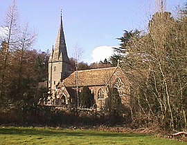
Hoarwithy is a pleasant, unspoilt village on the banks of the tranquil River Wye and is ideal for exploration. In a quietly beautiful part of Herefordshire, it has a ‘middle-of-nowhere’ feel without being too remote. it is nonetheless part of a rural scene that has hardly changed over the centuries. The impressive Italinate parish church of St. Catherine's, quite unlike any other Herefordshire church, can be found above the village of Hoarwithy, about 4 miles north of Ross-on-Wye. The original chapel was built in 1840 by Reverend Thomas Hutchinson, Curate in charge of Hentland Parish. In 1870, Prebendary William Poole, Vicar of Hentland 'beautified' the property he considered 'an ugly brick building with no pretensions to any style of architecture' in Southern Italian Romanesque and Byzantine styles. |
||||||||||||||||||||||
| BACK TO TOP | ||||||||||||||||||||||
|
Holme Lacy |
||||||||||||||||||||||
| BACK TO TOP | ||||||||||||||||||||||
|
The village of Kempley can be found in the North Forest of Dean district, and is surrounded by un spoilt countryside. Kempley has two churches, St. Mary's dates back to Norman times and because of the great historic value of the 12th century frescoes inside it is now managed by English Heritage, and the Courtauld Institute have recently taken on the task of preserving these relics. St. Edward's Church dates back to 1903 and was designed by Randall Wells during the Arts and Crafts movement. John Betjamin described St. Edward's as "a miniature cathedral of the Arts and Crafts Movement". Located between Kempley and Dymock village, lies the delightful Dymock Wood, which is varied in its array of wild flowers, especially in the spring, when you can see the daffodils and the bluebells. "Daffodil teas" are a traditional source of refreshment, held in the local village hall during the daffodil season. St. Mary's, Kempley St. Mary's church stands in a peaceful spot some distance away from the modern village. The most significant feature of the church is that it contains a group of frescoes which are among the best in the country. The tiny nave is early Norman, and the paintings here date from the 13th century. However, the best and oldest of the paintings are in the chancel. These frescoes date from 1130 and appear almost as fresh as when they were first painted, this being due to the Reformation whitewash and the Victorian varnish which was removed in 1872. The frescoes were restored to their original condition in 1955. Scenes in the chancel include Christ sitting on a rainbow blessing the world, while in the nave St. Michael weighs souls. |
||||||||||||||||||||||
| BACK TO TOP | ||||||||||||||||||||||
|
This small, thriving village on the edge of the Forest situated on the A40 road from Gloucester to Ross-on-Wye was here, with its own church, at least as early as 1100 A.D. It grew up at the foot of the Forest escarpment at the junction of two important Forest roads, the Gloucester - Ross road and the Gloucester - Mitcheldean road - both of which had their origins in the Roman period. These were both turn-piked in 1726 and the Toll House, which was built in c1830 still stands at the junction. A mainly agricultural parish, Huntley was early manor but is mainly notable for its Church of St John the Baptist, . The original Norman 12ht century church was demolished in 1861 except for its tower, during a major restoration undertaken by Teulon, the famous architect who was notable for his Decorated Gothic interpretations of earlier church building styles. The rebuilding was paid for by Huntley's rector, Daniel Capper, who gave the architect free reign and the resulting church proved to be one of Teulon's most enterprising and original designs, Teulon also built Huntley Manor (a mile to the North West) which, thanks to its decorated turrets has been described as a French chateau but in reality was another original design. St. John the Baptist : it is thought that the original church at Huntley was built about 1100 AD. It was certainly here in 1075 when it was listed amongst the possessions of the Benedictine Priory in Monmouth Castle. There is also record of it belonging to Monmouth Priory in a list of churches confirmed by the Bishop of Hereford in 1144. The stonework of the tower is dated to have been built around 1100. The church was virtually totally reconstructed in 1862 during the Victorian era of church building, and with the exception of the tower, is new work by the architect S. S. TEULON. In the main, he used local red sandstone, with quoins and dressings of a contrasting local limestone. A new spire was added to the old tower. The church bells include some which are very old, and which are still in use. The oldest is dated 1420, and bears the inscription "W. F., I. T., R. B. Bayli of Huntley, 1420". These refer to the churchwardens and the Earl of Shrewsbury's bailiff, as Huntley was at that time part of the Earl's estate. This bell has been ringing here for almost 600 years! The fourth bell bears an inscription in Latin, translated as "God save noble King James 1616". The tenor bell is dated 1670 and on it is marked the names of the "Church Wardens" Joseph WHYE and Thomas DRAPER. |
||||||||||||||||||||||
| BACK TO TOP | ||||||||||||||||||||||
 Llandogo Llandogo
The secret jewel in the heart of the of the Wye Valley Llandogo is a very attractive village nestling between wooded hillside roughly halfway between Monmouth and Chepstow, just north of Tintern Abbey. This stretch of the river Wye is considered to be one of the loveliest river valleys in Britain. William Wordsworth, who visited this area on many occasions, wrote about 'the cottages on the hills' and the 'wreaths of smoke' sent up in silence from among the trees. The village of Llandogo derives its name from the founder of the church of St. Oudoceus, who was the third Bishop of Llandaff in the 6th century. The present church was built on the same site Llandogo was a port before Chepstow and many of the local men were barge builders. In those distant days the village was open to much water traffic and had been so for centuries. The flat-bottomed Trow travelled the high seas then, carrying cargoes of bark and hazel hoops as far afield as Italy, and brining back barrels of sherry. The Llandogo Trow is immortalised by the name of a pub in Bristol to this day. There is a multitude of varied, exciting, peaceful and interesting walks within the vicinity of Llandogo. The zigzag walk from the stream at The Sloop Inn via the Cleddon Road and up to the Cleddon shoots is quite spectacular. This area is a grade one area of special scientific interest The small hamlet of Cleddon lies at the top of the walk and it was in Cleddon Hall that Bertrand Russell was born. Llandogo was once an important docking point for small sailing vessels, which worked, between South Wales and Bristol. The Sloop Inn has a certain romantic and historic connection with a pub on the other side of the Bristol Channel at Bristol Docks called the 'Llandogoer Trow'. A trow was a small sailing barge, the last one of which has just been restored and will be moored at the Ironbridge Museum in Shropshire. |
||||||||||||||||||||||
| BACK TO TOP | ||||||||||||||||||||||
|
Littledean is one of the ancient villages of the Forest of Dean. Situated a mile east of the town of Cinderford, it contains many old buildings dating back to the 1600's, and some even earlier. Littledean Hall, no longer open to the public, is one of these ancient buildings, and it is reputed to be one of the most haunted houses in England, though this is stoutly denied by its current owner who is at pains to discourage the notion..
The most noticeable building in the village is Littledean Gaol, an imposing structure designed by the London architect William Blackburn using locally quarried red sandstone, it was one of four identical gaols built in the country by Sir George Onesiphorus Paul in 1791 and is easily the best preserved. The public can visit it by prior arrangement. |
||||||||||||||||||||||
| BACK TO TOP | ||||||||||||||||||||||
|
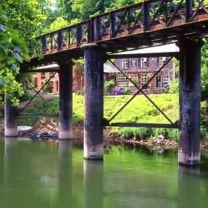
Lydbrook is a large village situated on the western edge of the Forest of Dean and adjacent to the Wye Valley. Many of the village houses are high on the valley hillsides. The Lydbrook valley was once the site of a thriving tinplate works, opened in 1871 and closed in 1925. The village also housed the large cable works factory built in 1912 by H. W. Smith & Co. The works supplied a vast quantity of field telephone cable during the First World War. The old railway, built in 1872 ran high along the hillside, and then crossed the valley on a huge viaduct on 90ft high stone piers. The viaduct was finally demolished in 1969. Without the heavy industry, the village is now a tranquil backwater. Lydbrook became established thanks to its deep valley, running down to the Wye from the central Forest. It offered a source of power (running water), close proximity to materials such as wood, stone and iron ore and also good communications and transport via the Wye. A mill existed at |
||||||||||||||||||||||
| BACK TO TOP | ||||||||||||||||||||||
|
Longhope, Gloucestershire Three miles to the south-west of Newent lies May Hill (National Trust Land). The hill rises to over 900 feet. The conifers on top of the hill were planted to commemorate the Golden Jubilee of Queen Victoria. The magnificent view from the top of May Hill stretches over Gloucestershire and extends to Bristol, on a clear day. May Hill itself can be clearly seen from over 45 miles from the north, and from Dundry 50 miles to the south, easily identifiable by the clump of trees on it's summit. |
||||||||||||||||||||||
| BACK TO TOP | ||||||||||||||||||||||
Mordiford is pure English countryside at its very best. It lies a few miles south of the cathedral city of Hereford and about a 30 minute journey north from Ross-on-Wye, which takes you through some of the lushest scenery in the Wye valley. Mordiford stands on the River Lugg, slightly above its junction with the better known River Wye. It is a beautiful river that snakes it's way through bountiful meadows, orchards and farmlands. Good fishing is to be enjoyed on the Lugg, it is known well for grayling. Mordiford itself is a patchwork of fields and wooded hills and little lanes that criss-cross here and there. Dotted around are beautiful old cottages, and farmhouses that hide behind an avenue of lofty trees. At Mordiford is a 600 year old bridge that has nine arches. Interestingly, it is said that in medieval times when the king rode over this bridge he was given a pair of silver spurs by the lords of Hereford and it is supposed that this was their payment for the manor of Mordiford. Fine as the scenery is in this wonderful area, for views that are truly spectacular you need to walk from the town to the top of Blackbury Hill. The vista's all around are stunning, the sparkling river lies below and in the distance, beyond the great cathedral of Hereford, you can see the misty tips of the Welsh mountains. This is a peaceful, lonely spot, often not a sound can be heard other than the twittering of birds as they circle even higher above you. Many species of wildlife thrive in the wooded areas that are spread throughout this beautiful region. You can roam in quiet tranquility along the forestry commission paths that take you past old oaks, firs and beech trees. Autumn is glorious, a never ending rainbow of brilliant greens, golds and rich reds. Leaves fall and form a thick carpet beneath your feet and a late after-noon sun dapples between the trees, the atmosphere is magical and you could be foriven for imagining an elf or two, with graceful fairies, dancing in the glade! This too, is fruit country and as you drive along the leafy lanes, you pass mile upon mile of orchards full of gorgeous english apples, pears and cherries. Fields are full of fresh strawberries and round every corner is a poster proclaiming P.Y.O. Giant hops grow throughout the region, for Herefordshire is famous for it's cider. You can have a wonderful day out here, you can relish the vast open spaces of Mordiford and the fine views over the Lugg from Blackbury Hill, you can savour the calm tranquility of the woods, and afterwards, you can seek out a friendly inn and part-take of a hearty supper, taken with a glass of local cider followed by strawberries and cream. |
||||||||||||||||||||||
| BACK TO TOP | ||||||||||||||||||||||
|
Penallt is a village in Monmouthshire, Wales. In the centre of the village, by the village green, is the seventeenth century village pub, the Bush Inn. Nearby, the Penallt Old Church Wood is a ten acre nature reserve managed by the Gwent Wildlife Trust. This deciduous woodland forms a habitat for Pied Flycatchers, Nuthatch, Tree Pipits, Treecreepers and Sparrowhawks, as well as plants such as Wild Daffodils and Moschatel. The Old Church is about a mile north of the village, and is mostly late mediaeval. The door bears the date 1539. The Church dedication is unknown, though there is a local tradition that it was St James, the patron saint of pilgrims.
The Wild Daffodil occurs in several places in Monmouthshire, such as Springdale Farm and Penallt Old Church Wood. However the greatest spectacle is provided by the slope below Margaret's Wood reserve, on the way to Whitebrook, where a carpet of thousands of flowers provides a wonderful display at the end of March and beginning of April. |
||||||||||||||||||||||
| BACK TO TOP | ||||||||||||||||||||||
|
Redbrook overlooks the River Wye and a riverside park created by the local community to mark the millennium. A little above the river is the 19th century Church of St Saviour. Redbrook was the northern terminus of the Wye Valley Railway. When it closed, its rails were taken up and sent to France during WWII. Situated on a attractive stretch of the Wye, Redbrook was an important industrial centre thanks to an ample supply of water power which ran down the valley and surrounding hills to the river. From Swan Pool down to the Wye, a number of leats, dams and reservoir ponds were created with many industrial sites including mills, an iron furnace, tinplate works and copper works. The oldest site is the King's Mill, which was a corn mill fist recorded in 1434 and remained in use until 1925. Though destroyed by fire some ruins and the wheel pit can still be seen by the road leading up the valley (following the track of the 812 Monmouth & Coleford Tramway).
The most obvious feature at Redbrook is the wooden pedestrian bridge which once carried the Wye Valley railway across the river and now forms part of the Wye Valley Path.The railway was opened in 1876 to connect Monmouth to the South Wales line and did not close until 1964. On the opposite side of the river by the bridge is The Boat Inn, which originated as a hostelry for river watermen and is now an attractive little unspoilt real ale pub. |
||||||||||||||||||||||
| BACK TO TOP | ||||||||||||||||||||||
|
Sellack is a scattered village and parish possessing much beautiful scenery, being on the borders of the river Wye in Herefordshire |
||||||||||||||||||||||
| BACK TO TOP | ||||||||||||||||||||||
|
Shirenewton is a small village, lying 5 miles (8 km) out of the town of Chepstow, Monmouthshire, UK. The village stands around 500 feet (154 m) above sea level, and has views of the Severn Estuary and the Bristol Channel. |
||||||||||||||||||||||
| BACK TO TOP | ||||||||||||||||||||||
|
St Arvan is a parish on the high road from Chepstow to Monmouth and Raglan.
|
||||||||||||||||||||||
| BACK TO TOP | ||||||||||||||||||||||
Staunton, "the place of the stones", was the ancient name given by the Anglo-Saxons. The village has stones of ancient origins and of mysterious forms, these are the Buck, Toad, Broad, Long and Queen Stone, all of which have origins dating back to the Bronze and Iron Ages. The Buckstone lies in Highmeadow Woods near the village. The huge rock on the summit of Buckstone Hill is said to have been used in Druid ceremonies, and actually used to rock before it was dislodged in 1885. This point is at 915 feet and one can view panoramic scenery such as views over the Forest of dean, Highmeadow Woods and the Black Mountains. The woods around Staunton are not actually part of the Royal Forest but are part of the Manor of Staunton. In the churchyard of All Saints Church, you will see the grave of David Mushet (1772-1847). With his son, he developed interest in the iron industry of Dean and laid much of the groundwork for the impending steel industry in Britain. |
||||||||||||||||||||||
| BACK TO TOP | ||||||||||||||||||||||
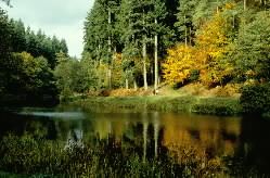 Soudley : A small but thriving village south of Cinderford, and the location of the excellent Dean Heritage Centre, and other attractions such as Soudley Ponds and the Blaize Bailey viewpoint. The ponds are a haven for wildlife and the surrounding paths are suitable for the less able and wheelchair users. A steep walk up the ridge takes you to the Blaize Bailey viewpoint overlooking the River Severn. |
||||||||||||||||||||||
| BACK TO TOP | ||||||||||||||||||||||
|
St. Briavels is a picturesque village just outside the market town of Lydney. An ancient connection connected with Hudnalls Woods involves the throwing of bread and cheese from the pound wall on Whitsunday evening. Records state that this custom follows the rights given by King John, and later confirmed by Charles II to the parishioners of the village. It was necessary for the rights of local people to continue to cut wood from the Hudnalls, nearby. The village has a small post office and a typical village garage, which inevitably adds to the rural character and charm. Within the village of St. Briavels, is a local craft outlet, and hostelries offering refreshment. |
||||||||||||||||||||||
| BACK TO TOP | ||||||||||||||||||||||
|
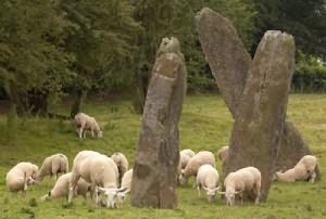
The village of Trellech, lies between Monmouth and Chepstow and is home to a marvellous collection of antiquities. Now really just a sleepy hamlet, this was once one of the most important towns in Wales - in its medieval heyday it was larger than Newport and Chepstow. The standing stones pictured here indicate that the area was important even in prehistoric times.The stones may once have been part of an ancient large avenue or stone circle. The Trellech standing stones might look as though they were made from an early form of concrete but they are in fact large pieces of a volcanic rock locally known as pudding stone. This material was used to make certain types of millstone in days gone by. A 19th. century historian noted that a fourth stone once stood nearby but was destroyed towards the end of the 18th. century. |
||||||||||||||||||||||
| BACK TO TOP | ||||||||||||||||||||||
|
Welsh Bicknor is an area of Herefordshire. It was historically a detached parish of the traditional county of Monmouthshire. |
||||||||||||||||||||||
| BACK TO TOP | ||||||||||||||||||||||
|
The village of Westbury on Severn from the Forest of Dean.
Visit the unusual parish church with its detached spire, and eat at the Red Lion Inn beside the church. Westbury parish hall is home to football and rugby in the winter, and cricket in the summer, the Golden Age Brownies, the Parish Council, and the Westbury Players, whose pantomimes are legendary. Visit in July and join in the fun and festivities at the carnival. |
||||||||||||||||||||||
| BACK TO TOP | ||||||||||||||||||||||
|
Whitebrook is in the heart of the breathtaking Wye Valley in a hidden valley amongst the rolling countryside, It is a perfect base for exploring. This area of the Wye Valley has justifiably been designated an "area of outstanding natural beauty", with rugged limestone outcrops and gentle pastures offering the delights of the Wye Valley Walk and Offa's Dyke path. The Wild Daffodil occurs in several places in Monmouthshire, such as Springdale Farm and Penallt Old Church Wood. |
||||||||||||||||||||||
| BACK TO TOP | ||||||||||||||||||||||
|
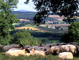
Woolhope Dome This zone is divided into two more-or-less distinct parts. In the north is Haugh Wood and a high density of smaller woods on the relatively steep contours of the Woolhope Dome. The southern part has fewer woods, a gentler landscape and more intensive agriculture. The area includes a mosaic of the remains of old orchards, some fine examples of unimproved limestone grasslands and many old hedges and sunken tracks or 'sunkways' Most fields retain their hedges, although these are heavily trimmed. There are relatively few hedge trees in the south of this area, but there are more to the north, many of them mature oak trees. Several field boundaries are now formed from old hedge trees and overgrown hedges. Some hedges have been removed to form large arable fields. The great majority of fields are used to grow arable crops, with a limited number used for sheep and cattle grazing. This zone contains a number of small villages and hamlets including Woolhope, Mordiford, part of Fownhope and Brockhampton. Several of the villages contain black-and-white timber framed buildings characteristic of Herefordshire. |
||||||||||||||||||||||
| BACK TO TOP | ||||||||||||||||||||||
|
||||||||||||||||||||||
|
||||||||||||||||||||||
|
||||||||||||||||||||||
Towns and Villages in and around
the |
||||||||||||||||||||||
| This page last modified Tuesday, 28-May-2019 10:59:03 CEST | ||||||||||||||||||||||
Royal Forest of Dean Info 110 High Street Broadway Worcestershire England UK WR12 7AJ Manager, Richard Pinder, E-Mail: webmaster@royalforestofdean.info
Contact Us About Us Media and Press Advertising
Opportunities
Copyright © 2014 - 2019 All rights reserved |
||||||||||||||||||||||
 sides.
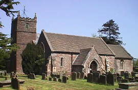
 At this time, the manor and much of the parish was owned by
 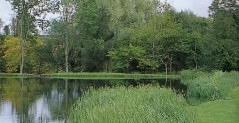 Alvington is located on the lower slopes of the Severn escarpment, about 5 kilometres south-west of
  Awre offers low-lying and fertile riverside land which has been utilised for the farming industry, which has given it its "working" village atmosphere with its farms.
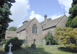 Aylburton is a small village on the A48 road, just south of
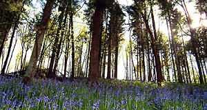 The Aylburton Memorial Hall commemorates the village's fallen in two World Wars and was completed in 1922. St. Mary's - St. Mary's Church, although erected as late as 1857 incorporates much of the original 14th century fabric having been moves stone by stone from Chapel Hill, behind the village, at that time. The 15th century pulpit is one of only sixty left in England today.
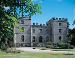
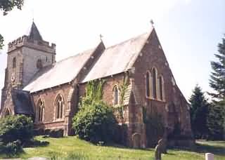 Henry Crawshay acquired most of Blaisdon in the 1860's, and rebuilt the nave of the church in 1866. Blaisdon Hall was built in 1876 for his son Edwin. By 1890 the hall and most of the estate had passed to Peter Stubbs, who built the entrance Lodge to Blaisdon Hall, the Village hall and the Forge. At the stud farm he bred Blaisdon Conqueror - the worlds largest shire horse, whose bones lie in the British Museum. On his death in 1906 Peter Stubbs eldest daughter, Mary Helen Macwer inherited the main hall and built the estate houses in the village centre, and the Gamekeepers Lodge. With her husband Colin, she ran the Estate until her death in 1928.The Salesians of Don Bosco acquired Blaisdon Hall as a seminary in the 1930's, and ran the Stud farm as a mixed farm school. A valued part of the village community, all visitors were made welcome at their home, until they left in 1995. Hartpury Agricultural College took the hall until 1999 when it returned to private ownership.
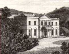
 Brampton Abbots in
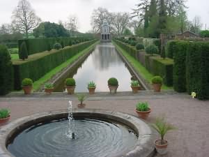
 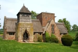 The Brockhampton Estate, near Bromyard, is a National Trust Property. The estate comprises some 2000 acres (680 hectares) of farmland and ancient woodland, including some of the finest oaks in the country. Lying within the estate is a moated timbered farmhouse. The farmhouse is referred to as Lower Brockhampton. A narrow winding road, nearly 2 miles long, leads from the estate entrance to the farmhouse.
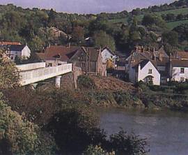 Brockweir is a small but attractive village located alongside the River Wye, where there used to be a boat building industry. It is reported that vessels up to 90 tonnes could reach this point from the sea, where their cargoes were transferred to shallow barges and hauled up the river by teams of men.
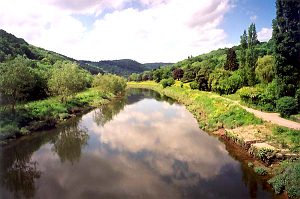 Many of the buildings had river connections, acting as warehouses and although today only one public house remains, there were once 16 inns to satisfy the demands of locals, watermen and shipbuilders!
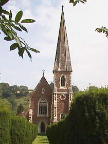
 The
The  The village of Devauden is situated in the
 English Bicknor is first recorded as a hamlet in 1066. A primarily agricultural and industrial area, its main attraction today is the small Norman Church of St Mary which has excellent internal masonry and sculpture dating from the 12th century. The original tower was situated centrally but was built from the soft local sandstone which became unsafe. The church is also interesting because it is sited within the outer courtyard of the motte and bailey castle. Norman masonry has been found within the motte, suggesting at least part was built in stone and while nothing is left of the castle's actual structure today, its location is still identifiable.
 The village was once the site of Roman occupation, and the remains of the Roman temple can be seen in the grounds of the Hall. Even earlier, the hillside to the east of the village was the site of an ancient encampment and the hillside still bears traces of the banks and ditches of the fortifications. Littledean grew up at the centre of a network of ancient Forest tracks (notably the Roman road which led up from the ford and ferry at
 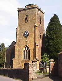 Littledean's Church of St Ethlebert was built in the late 12th century with the tower added in the 14th century. Today this has a rather truncated appearance, because the tower originally had a spire which was destroyed in a severe gale in 1894 and never rebuilt. Other buildings of interest are the Red House an early building, possibly with a Norman Core, the Old Coaching Inn and Littledean Hall. Also known as Dean Hall, this is reputed to be the oldest known house in Gloucestershire. The present house is 16ht century in date, with an early17th century north wing and a mid 19th century top story. Within the grounds of Littledean Hall is a Roman temple, sited at a springhead on the edge of the Forest escarpment. It was only discovered in the early 1980's and subsequent archaeological excavation revealed a complex history. Perhaps the most interesting artifact from the site is a piece of sandstone which has a primitive face carved on one side. This was found on the site in 1991 and is of Celtic origin. As the Romans often adopted local religions and sacred sites, it is thought that Littledean temple was built as a water shrine dedicated to the. deity of the River Severn and its bore, for the site has excellent views of the great horseshoe bend in the river.
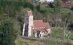
 Lydbrook as early as 1282 by the late 15th century, there were three forges, a lime kiln a tinplate works and a wire-works. It became the principle coal port on the
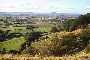

 The Argoed, a seventeenth-century mansion, lies to the south east of the village. It was once owned by the father of Beatrice Webb, the British socialist, economist and reformer.
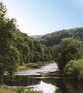
 The Redbrook Copper Works was established c1960 using ore brought from Cornwall via
 The name Shirenewton has had several variations over the years, such as Sheref Newton, Neweton, Nether Went, and Nova Villa. The present name derives from the creation of the village in a forest clearing by the Sheriff of
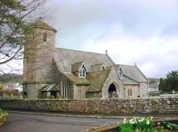
 The church was almost completely restored in 1883-4, under the directon of Mr. Pritchard, architect, at a cost of about £2,000, of which £500 was contributed by Mrs. Clay, of Piercefield, and the church was reopened 26 Feb. 1884: there are 300 sittings. The register dates from the year 1686, when all previous registers were burnt. The living is now a vicarage, with Penterry annexed in 1888, joint net yearly income £200, with 42 acres of glebe here and residence in the gift of the Bishop of Llandaff and the Duke of Beaufort alternately, and held since 1887 by the Rev. John Tilley.
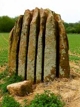
 The
The 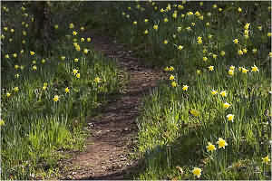
 Woolhope is a village in